 Oceania & Pacific · Modernised and illustrated edition
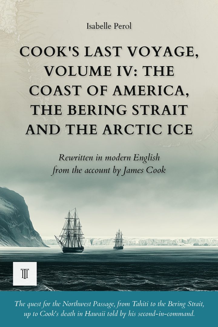
Cook's Last Voyage, Volume IV: The Coast of America, the Bering Strait and the Arctic Ice
Modernized, illustrated English edition of A Voyage to the Pacific Ocean by James Cook (1776-1780). 396 pages.
1778-1779: James Cook sails up the north-west coast of America, crosses the Bering Strait, then anchors at Hawaii, where his journal comes to an end. Volume IV of the last voyage, rewritten in modern English, maps and illustrations.
Read more ↓- 396 pages
- Paperback · Ebook (EPUB)
- English
- 18th century
About this book
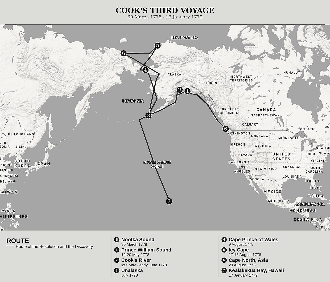
March 1778. After a month at Nootka Sound, among the traders of sea otter skins, the Resolution and the Discovery sail up a coast that no European chart yet shows. James Cook is searching for the Northwest Passage, that dreamed-of channel meant to link the two oceans, and he searches for it with the stubbornness of a man on his third voyage around the world.
Every bay becomes a promise, every estuary a disappointment. The great river that will bear his name leads only to sandbanks. Prince William Sound hides thieves. In the Aleutians, paddlers hand over notes written in Russian: other Europeans are already there, hidden in the fog for half a century. Then the ships cross the Bering Strait and run, at Icy Cape, into a wall of pack ice as high as a cliff, where thousands of walruses wallow and roar.
The Arctic refuses the passage. The surgeon Anderson dies within sight of the island that will bear his name. Defeated by the ice, Cook turns back south toward the Sandwich Islands to spend the winter there, discovers Hawaii and its snow-capped peaks, and at last anchors in a bay where a thousand canoes surround his ships. It is there, on that page, that the journal kept in his own hand stops forever.
This fourth volume corresponds to Book IV of the original edition, A Voyage to the Pacific Ocean (London, 1784): from the arrival at Nootka Sound at the end of March 1778 to the anchorage in Kealakekua Bay on 17 January 1779. It is the last text written in James Cook's own hand; after this page, the account of the voyage is taken up by Captain James King in the volumes that follow. Along the way, the fanciful map drawn by the geographer Stæhlin, which promised an easy passage from Asia, is tested against direct observation and found false.
Fourth of the six volumes devoted to James Cook's third and last voyage, in the Forgotten Travel Journals collection. Each volume can be read on its own.
The first complete modern rewriting for today's reader, making this account accessible without betraying anything of the voyage. Twenty-one original illustrations and redrawn maps bring the route to life, while a set of reference materials (glossary, timeline, index, editor's note, afterword, and further reading) and selected passages from the original text illuminate the reading.
Product details
- Publisher
- Itinerarium Éditions
- Series
- Oceania & Pacific
- The author
- James Cook
- Date of the journey
- 1778-1779
- Modern edition by
- Isabelle Perol
- Language
- English
- Format
- Paperback, 6 × 9 in (15.2 × 22.9 cm)
- Pages
- 396
- ISBN
- 978-2-489331-36-3
- Published
- August 2026
The author
James Cook
A British Royal Navy officer, James Cook (1728-1779) commanded the Resolution on his third and last voyage around the world, from 1776 to 1779. The son of a Yorkshire day-labourer who became the finest navigator of his age during the Seven Years' War, he was given orders by the Admiralty to search, north of America, for the passage that would link the two oceans. This fourth volume shows him sailing up a coast that no European chart yet shows, from Nootka Sound to the Bering Strait and the Arctic ice pack, before anchoring at Hawaii. It is the last text Cook writes in his own hand: a few weeks later, he meets his death at Kealakekua.
All books by James Cook →A Voyage to the Pacific Ocean: Our editorial work
This fourth volume contains Book IV of the official account: ten months of sailing, from the ships' entry into Nootka Sound at the end of March 1778 to the anchorage in Kealakekua Bay on 17 January 1779. The material occupies the second of the three quarto volumes that Canon John Douglas had printed in London in 1784 from the ships' journals. The rules set out at the head of the series apply here without reservation; this note records only what this volume required of its own.
The essential fact fits in one line that the 1784 edition prints at the foot of the last page of Book IV: "Here Captain Cook's journal ends." The chapters just read are therefore the last that Cook ever wrote; from the next volume on, it is Captain James King who will tell the story. The same volume sees the journal's second voice fall silent: William Anderson, the surgeon who lent the previous volumes his knowledge of plants, birds and languages, dies of consumption on 3 August 1778, off an island that at once takes his name. After him there is no relay: for the first time since leaving England, the commander's voice remains alone on stage from beginning to end.
The division has scarcely moved. Twelve chapters in the original, thirteen in this volume: only one, the eleventh, carried two matters that Cook himself separates with a single sentence, at the point where he leaves the thread of the days to announce his portrait of the inhabitants; the cut falls at that seam, between the ships' return to Unalaska and the picture of the Aleut people. Nothing has been merged, nothing moved, and every modern chapter follows its original chapter in one unbroken span. The notes that Douglas scattered at the foot of the pages, references to the compilers of the Russian discoveries, Muller or Coxe, extracts from Lieutenant King's journal, have left the body of the narrative; their substance now feeds the reference material gathered at the end of the book.
Before / after
We now stood to the Southward; and, after running six leagues, shoaled the water to seven fathoms; but it soon deepened to nine fathoms. At this time, the weather, which had been hazy, clearing up a little, we saw land extending from South to South East by East, about three or four miles distant. The Eastern extreme forms a point, which was much incumbered with ice; for which reason it obtained the name of Icy Cape. Its latitude is 70° 29', and its longitude 198° 20'.
I then made a course south. After six leagues, the bottom rose again to seven fathoms, then soon deepened to nine. The weather, hazy since morning, cleared a little, and land appeared, stretching from south to southeast by east, three or four miles from us. Its eastern extremity forms a point so choked with ice that it earned the name Icy Cape: 70° 29' latitude, 198° 20' longitude.
The journey mapped
The modern editor

More in this series
See all →