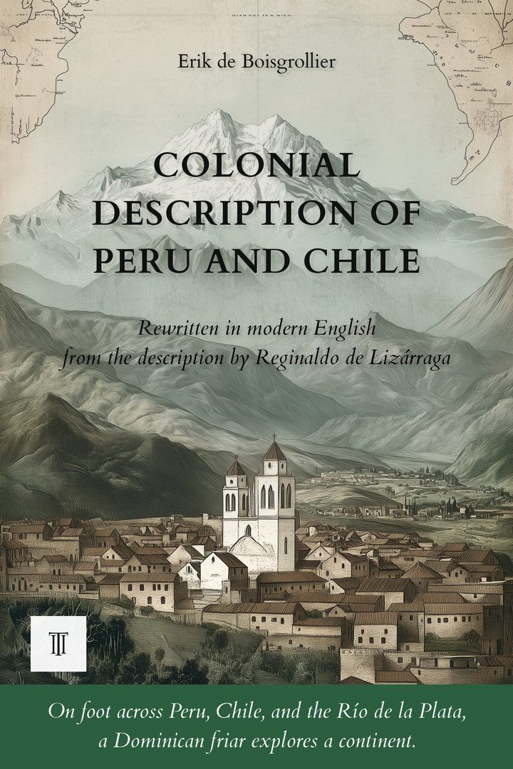
 Wild Americas · Modernised and illustrated edition
Colonial Description of Peru and Chile
Modernized, illustrated English edition of Descripción del Perú, Tucumán, Río de la Plata y Chile by Reginaldo de Lizárraga (c. 1605). 616 pages.
Around 1605, a Spanish Dominican friar completes half a century of exploration of the New World, from Quito to the Strait of Magellan. A first-rank witness judges colonial America without sparing anyone.
Read more ↓- 616 pages
- Paperback · Ebook (EPUB)
- English
- 16th century
About this book
Around 1605, in a convent in Paraguay, Reginaldo de Lizárraga completes a manuscript begun fifteen years earlier. Arriving in Peru at the age of fifteen with his parents, this Spaniard took the Dominican habit and, for half a century, traveled the immense lands stretching from Quito to the Strait of Magellan. Prior, provincial, and finally bishop, he watched Lima in the days of its unfinished cathedral, Potosí at the height of its mining wealth, and Cuzco in the years after the execution of the last Inca. He crossed the northern valleys of Peru and the sands where the huacas of Trujillo lie, climbed into the heart of the Andes, and lingered on the shores of Lake Titicaca before entering the troubled province of Charcas, where the Chiriguano held the frontier. He saw Francis Drake slip into the roadstead of Callao one night, the fury of the Chiriguano overwhelm Viceroy Toledo's expedition against the last Inca of Vilcabamba, and the unconquered Mapuche of Chile kill Governor Martín García de Loyola at Curalaba.
His book is a living inventory of the Spanish New World: cities, valleys, mines, convents, viceroys, Indians, pirates, and martyrs, described by a witness who traveled it all on muleback and judged none of it gently. He portrays the viceroys in arms, from the marquis of Cañete to Toledo the reformer, follows the corsair's shadow along the Pacific coast in the years after Drake's raid, and reaches, beyond Tucumán and the waters of Paraguay, the islands at the end of the world and the unsubdued frontiers of Chile. Left unpublished for three centuries, the manuscript was not printed until 1909, in Buenos Aires. This English edition restores it in the full density of its documentary and literary substance, faithful to the voice of a man who made the New World his home for sixty years and who spared no one his judgment, neither colonist nor Indian, neither pirate nor fellow friar.
The whole is illustrated with fifteen original engravings, accompanied by six maps of sixteenth-century colonial America, a glossary of colonial terms, a chronology of the author and his era, an index of persons and an index of places, as well as selected passages from the original Spanish text.
Product details
- Publisher
- Itinerarium Éditions
- Series
- Wild Americas
- The author
- Reginaldo de Lizárraga
- Date of the journey
- fin XVIe s.
- Modern edition by
- Erik de Boisgrollier
- Language
- English
- Format
- Paperback, 6 × 9 in (15.2 × 22.9 cm)
- Pages
- 616
- ISBN
- 978-2-489330-58-8
- Published
- June 2026
The author
Reginaldo de Lizárraga
Reginaldo de Lizárraga (c. 1539-1615) was a Spanish-born Dominican friar. Brought to Peru as a child with his parents, he took the Dominican habit and, over nearly half a century, traveled the territories of Spanish America from Quito to the Strait of Magellan, holding various conventual offices before rising to the episcopate. Around 1605, in a convent in Paraguay, he completed his Descripción colonial, a vast inventory of the New World grounded in what he saw with his own eyes. Left unpublished for a long time, his account is today counted among the richest testimonies on late sixteenth-century Peru and Chile.
All books by Reginaldo de Lizárraga →Descripción del Perú: Our editorial work
The manuscript of Reginaldo de Lizárraga is one of those texts that, having waited three centuries before being printed, retain even in their modern edition something of their first freshness. Ricardo Rojas published it in Buenos Aires in 1909 in his Biblioteca Argentina, from a late seventeenth-century copy. The text preserves the structure the author gave it: a libro primero of one hundred and sixteen capitulos that descends from the equatorial Pacific to the Strait of Magellan by way of the valleys of northern Peru, Lima, the southern coast, Quito, Cuzco, the Collao, Charcas, Potosí; a libro segundo of eighty-eight capitulos devoted to ecclesiastical and political institutions, to the viceroys, the pirates, the governors of Chile and Paraguay. Each capitulo runs sometimes half a page, sometimes four or five, with no evident hierarchy.
The present edition brings the two books together into a single volume of twenty-three chapters. The logic of the regrouping is geographical: the author's capitulos have been distributed among the chapters corresponding to the territory they describe. Quito has its chapter, Cuzco has its own, Potosí is treated within the chapter devoted to Charcas, Chile has two consecutive chapters. Lima, owing to the scope Lizárraga gives it, occupies three chapters. The capitulos of the libro segundo that deal with the viceroys and the bishops, more political than geographical in nature, are distributed to their place within the chronology of the narrative. No capitulo has been cut without its essential substance being retained; a few lists of bishops or encomenderos have been condensed where they strung together the same formulas across several pages, but the judgments, the portraits, the scenes of battle or procession are preserved in full.
Before / after
No creo ha habido en el mundo ciudad que en tan breve tiempo haya crecido en número de monasterios, ni iguale á los religiosos que en ellos sirven á Dios, alabándole de dia y de noche, y ejercitándose en letras para el bien de las ánimas, como esta de Los Reyes, habiendo ayudado muy poco ó nada los príncipes y gobernadores destos reinos al edificio dellos. El más principal y el primero della es el nuestro, llamado Nuestra Señora del Rosario; no ha 68 años que se fundó; el primer fundador fué el padre fray Juan de Olias; su sitio es una cuadra de la plaza y muy cercado al rio.…
I do not believe there has ever been a city in the world that, in so short a time, achieved such growth in the number of its convents. Nor do I believe there exists one where you would find the equal of the religious who serve God here, praising Him day and night, devoting themselves to letters for the salvation of souls. This truly is the City of the Kings. And all this came about even though the princes and governors of these kingdoms have given almost nothing toward building these houses. The first of all these convents, and the most important, is our own, dedicated to Our Lady of the Rosary.
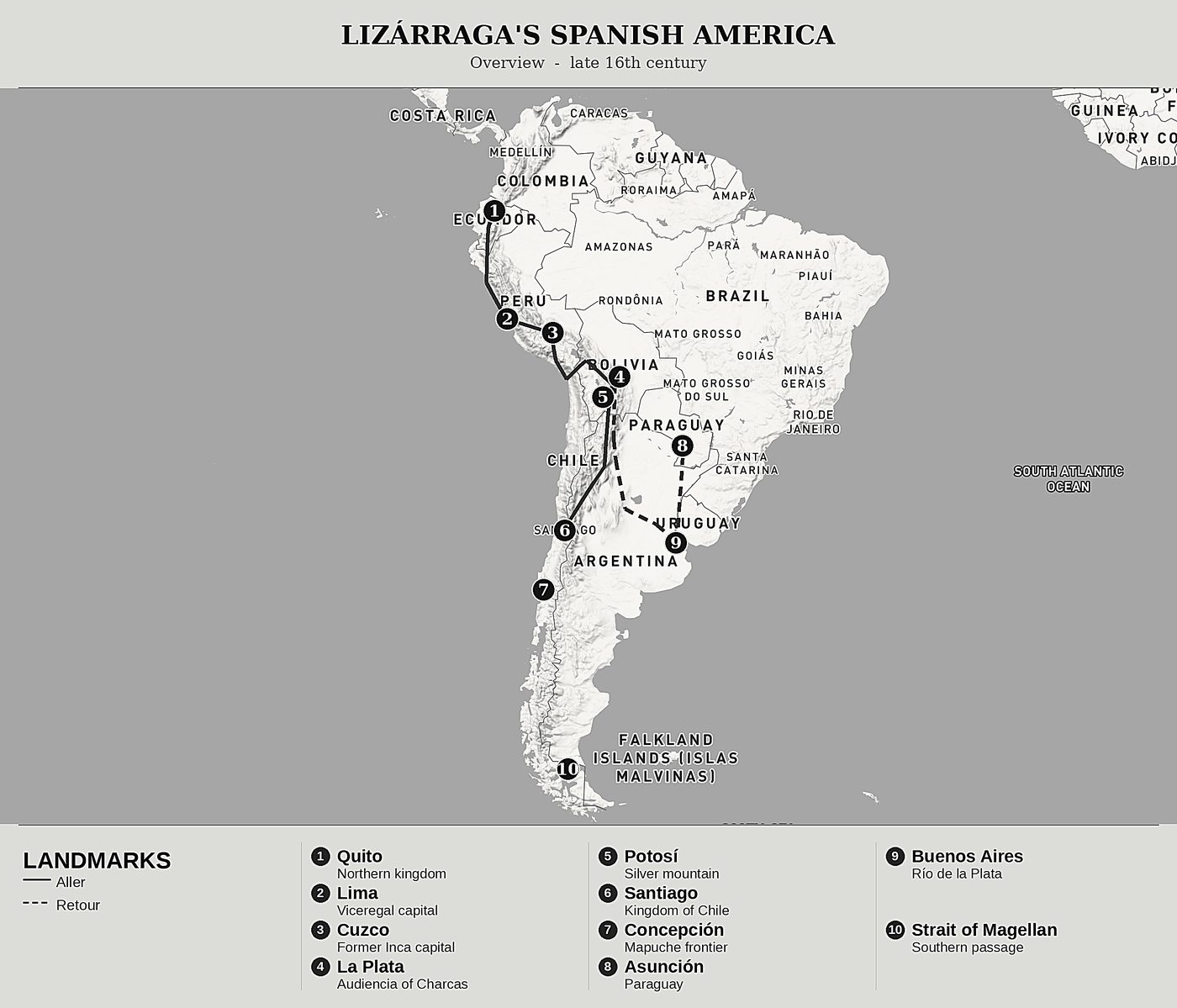
The journey mapped
The modern editor